
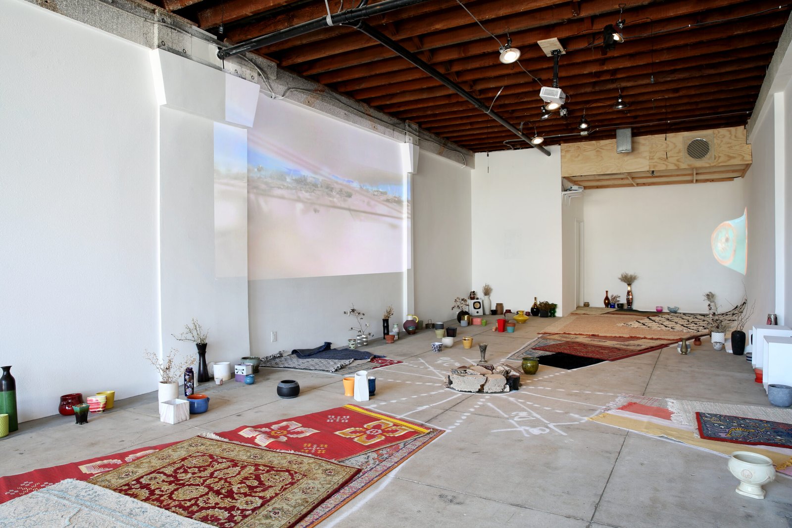
Reisig and Taylor Contemporary is presenting Ground Truthing, a solo exhibition by Kim Zumpfe (with the projected multimedia work “GroundTruthing.Schrapnel” made in collaboration with Luke Quezada). This is Zumpfe’s first exhibition with the gallery. Ground Truthing is on view in Los Angeles from May 23 – June 27, 2026.
Testing, testing: What is targeted by imaging systems? From where? Who is (not) there? What populates this place?
….
GROUND TRUTHING
We are contained in the cloud
Containers stand by
latent compressions and dormant potentials
Baseline control survey scars
soft scatter zones and hard fragmentation patterns
Fixed Footprints
area matter and marking upwards
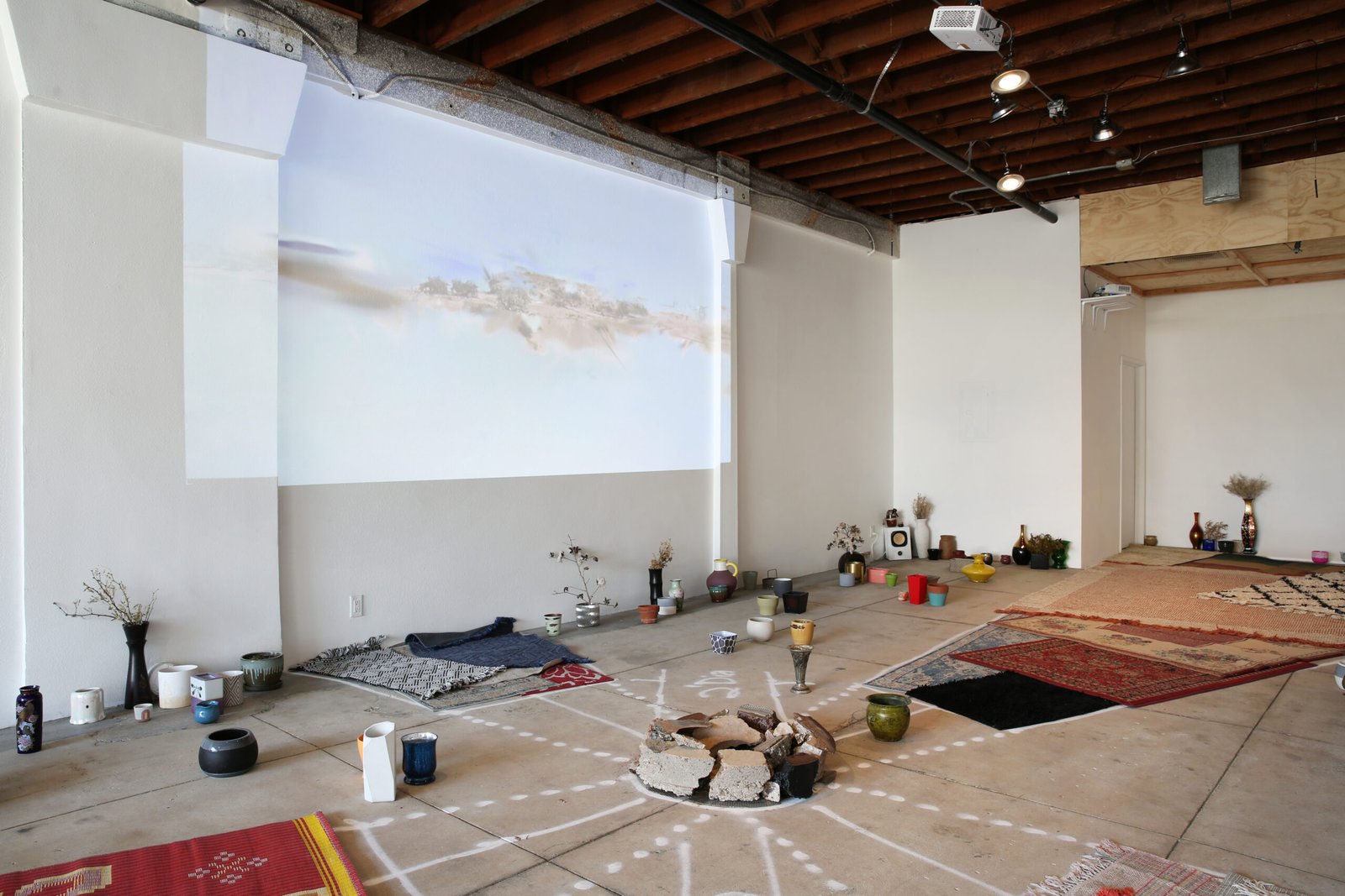
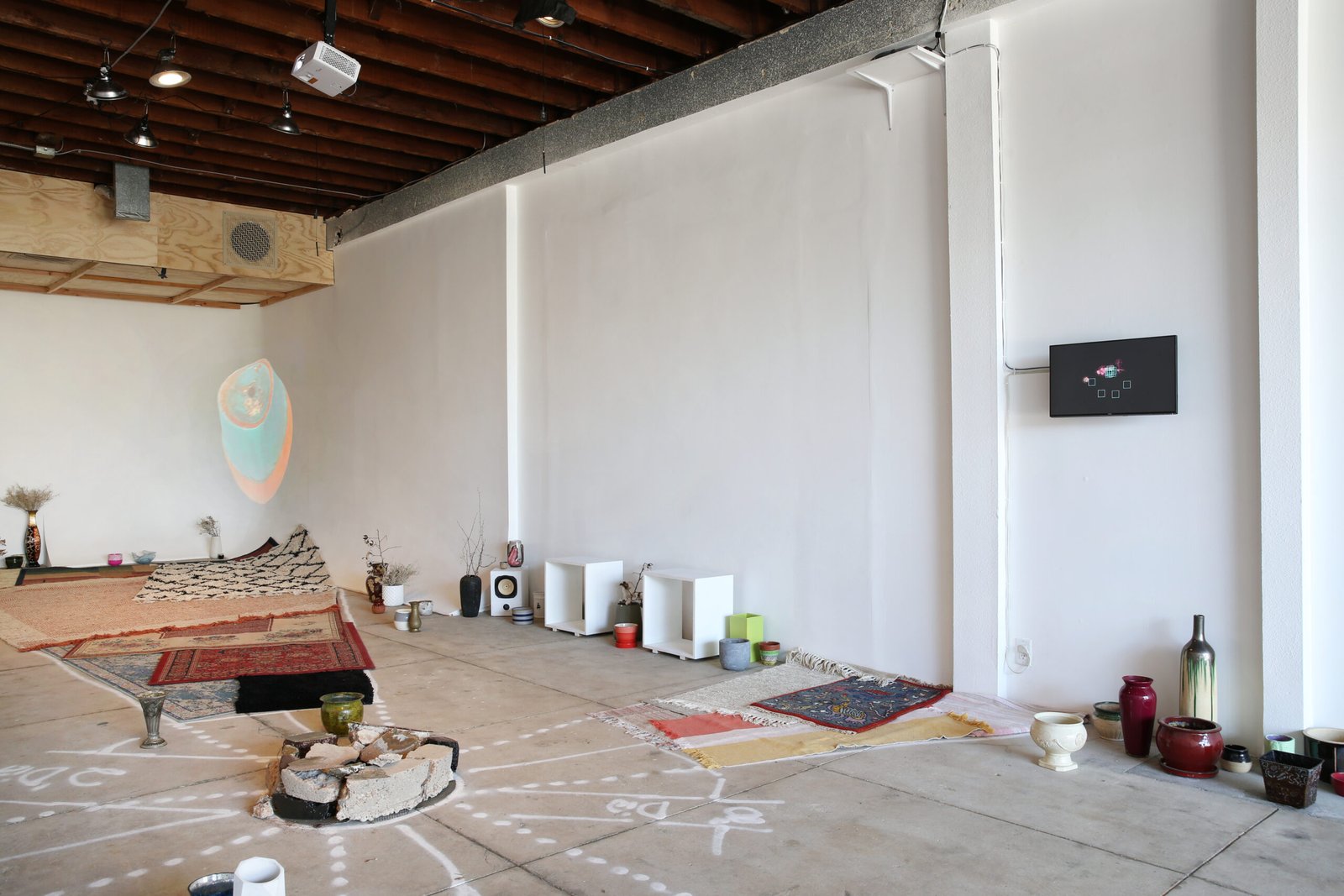
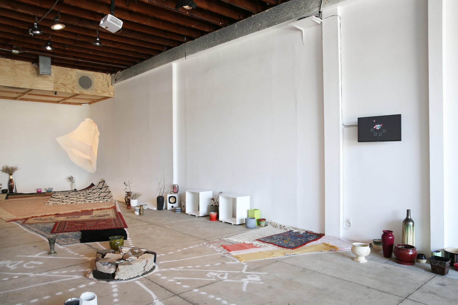
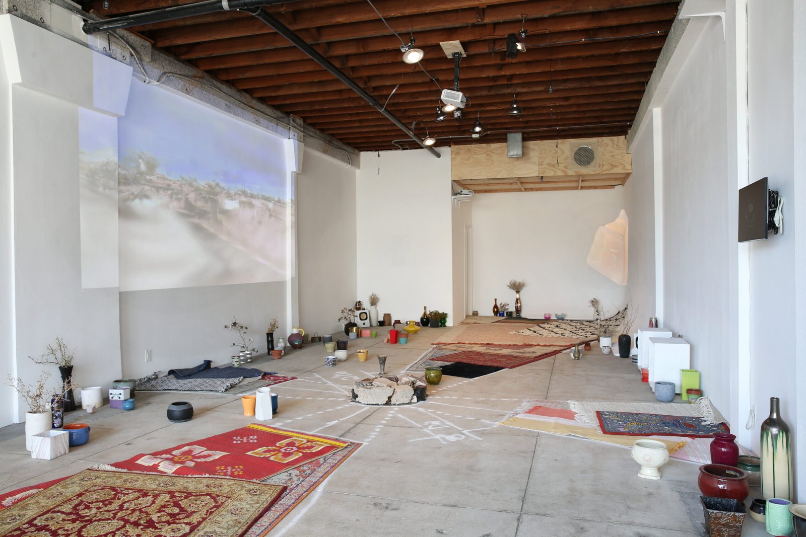
Ground Truthing explores the origins and development of photogrammetry and GPS imaging related to domestic home objects, often used for comfort and to elevate character and delight in home spaces. The term “ground truthing” was used by NASA and the military to describe observational data of the earth’s surface to develop certainties about location, originally developed as a technique for space exploration and reconnaissance missions. The Arizona desert holds an array of over 250 large concrete Maltese-shaped crosses that can still be viewed on GPS mapping systems. These are the Casa Grande Corona Photogrammetric Test Range, once used to calibrate satellite technology in the 1960’s. This infrastructure allowed engineers to lay a groundwork for GPS, now considered a public good. The everyday use of ground truthing through GPS created a new global imagination of verifiable geographic space that became micro-locational and targeted. The mid-air photographic systems developed for the Corona Program provided high accuracy “clear pictures” with spatial precision. This is now reversed for GPS, where “good enough” imagery is distributed to the public with low resolution, interference, and signal manipulation. Our mapped homes are always a little blurry, and rarely updated.
Ground Truthing poetically considers navigation and positioning embedded in GPS and coordinated satellite systems in relationship to social imaginations of the constructs of home base. There are far-reaching individual desires to shape the home decoratively as a central place for self-curation with idealized standards of living, an upwardly mobile desire to give oneself a sense of self and security. This artwork offers alternative ground truthing models in physical and digital space that focus on missing information, gaps in data capturing, inconsistencies in gridded systems, and ground-level restructurings. Locations viewable through everyday aerial mapping technologies are linked to contemporary realities and fantasies of place-making, spatial movement, and targeted self-locations. This work provides experimental interactive compositions related to concepts of home and place that includes: 3D models and audio field recordings from site visits to the Casa Grande Test Range, related historical and archival images, aerial satellite imaging, declassified government documents, and home decorations. The works created for this exhibition enact a meditation on perceptual distortions of the lived-on surface of the earth.
—KZ